


Mill Run Voting District, Loudoun County, Virginia
About
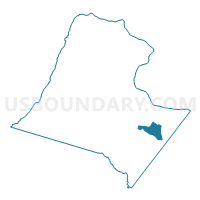
Outline

Summary
| Unique Area Identifier | 682033 |
| Name | Mill Run Voting District |
| County | Loudoun County |
| State | Virginia |
| Area (square miles) | 6.65 |
| Land Area (square miles) | 6.57 |
| Water Area (square miles) | 0.08 |
| % of Land Area | 98.79 |
| % of Water Area | 1.21 |
| Latitude of the Internal Point | 39.00181430 |
| Longtitude of the Internal Point | -77.45771130 |
Maps


Graphs
Select a template below for downloading or customizing gragh for Mill Run Voting District, Loudoun County, Virginia


Neighbors
Neighoring Voting District (by Name) Neighboring Voting District on the Map
- Ashburn Farm Voting District, Loudoun County, VA
- Buchanan Voting District, Loudoun County, VA
- Carter Voting District, Loudoun County, VA
- Claude Moore Park Voting District, Loudoun County, VA
- Dominion Voting District, Loudoun County, VA
- Dulles South Voting District, Loudoun County, VA
- Eagle Ridge Voting District, Loudoun County, VA
- Farmwell Station Voting District, Loudoun County, VA
- Hillside Voting District, Loudoun County, VA
- Oak Grove Voting District, Loudoun County, VA
Top 10 Neighboring County Subdivision (by Population) Neighboring County Subdivision on the Map
- Dulles district, Loudoun County, VA (81,409)
- Broad Run district, Loudoun County, VA (51,113)
- Potomac district, Loudoun County, VA (27,673)
Top 10 Neighboring Place (by Population) Neighboring Place on the Map
- Ashburn CDP, VA (43,511)
- Sterling CDP, VA (27,822)
- Broadlands CDP, VA (12,313)
- Dulles Town Center CDP, VA (4,601)
- Oak Grove CDP, VA (1,777)
- Moorefield Station CDP, VA (77)
Top 10 Neighboring Unified School District (by Population) Neighboring Unified School District on the Map
Top 10 Neighboring State Legislative District Lower Chamber (by Population) Neighboring State Legislative District Lower Chamber on the Map
- State House District 13, VA (190,620)
- State House District 32, VA (112,677)
- State House District 86, VA (89,028)
- State House District 67, VA (87,457)
Top 10 Neighboring State Legislative District Upper Chamber (by Population) Neighboring State Legislative District Upper Chamber on the Map
Top 10 Neighboring 111th Congressional District (by Population) Neighboring 111th Congressional District on the Map
Top 10 Neighboring Census Tract (by Population) Neighboring Census Tract on the Map
- Census Tract 6117, Loudoun County, VA (6,329)
- Census Tract 6110.22, Loudoun County, VA (5,872)
- Census Tract 6110.23, Loudoun County, VA (5,746)
- Census Tract 6115.02, Loudoun County, VA (5,702)
- Census Tract 6110.19, Loudoun County, VA (5,593)
- Census Tract 6110.21, Loudoun County, VA (5,051)
- Census Tract 6110.06, Loudoun County, VA (4,997)
- Census Tract 6110.20, Loudoun County, VA (4,832)
- Census Tract 6116.01, Loudoun County, VA (3,995)
- Census Tract 6110.18, Loudoun County, VA (2,228)